

Dubline - Digital wayfinding for Dublin
Dublin is a world-class city and attractive international tourist destination with a rich heritage and vibrant culture. Commencing in 2005 fwdesign has collaborated closely with the City Council and other key local stakeholders with the strategic planning, design and phased development of a bespoke, integrated pedestrian wayfinding provision. Detailed to accessibly promote key attractions and destinations the signage system is implemented seamlessly across the city centre. Consistent on-line digital mapping and free issue hand held printed maps complement the wayfinding provision.
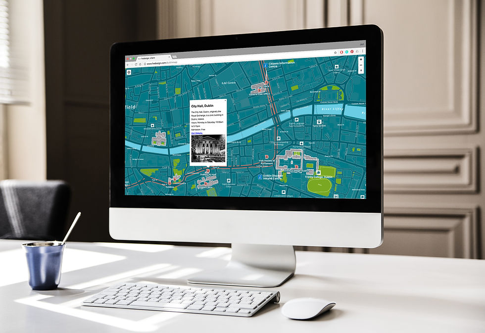
Recent developments in mobile communications and the widespread adoption of touch screen mobile phones and tablets have opened up exciting new opportunities for enhanced digital promotion and interactive access to greater tears of destination wayfinding and interpretive information.
To illustrate a potential application and demonstrate this new potential we have created a draft digital Dubline heritage trail. Accessible from desktop and mobile platforms the digital city maps are fully interactive with enhanced features to promote key heritage attractions including dedicated ‘hotspots’ providing further imagery, greater location information and links to dedicated destination websites.


